LANDSCAPE · E0059
张掖丹霞:一部被折叠的地质时间
Zhangye Danxia: A Folded Record of Time
WORD BY WORD
进入逐词听读模式
顶部配图随进度轮播,未读文字为白色,读到后逐词变黄。
从红色砂岩、砾岩和泥岩层,到奥河褶皱、干旱侵蚀与保护性观景步道,理解张掖七彩丹霞如何记录地质时间。
THREE THINGS TO KNOW
- 01
张掖世界地质公园位于甘肃省张掖市,处在祁连山地区,以彩色丘陵和丹霞地貌著称。
- 02
张掖丹霞的红层地貌由红色碎屑岩组成,构造运动、风雨侵蚀、溶蚀、水流切割和重力崩塌等过程共同塑造其形态。
- 03
祁连山前的早白垩世砂岩、砾岩和泥岩等沉积层,后来经历新构造运动、侵蚀和风化,形成彩色丘陵。
BILINGUAL TRANSCRIPT
双语全文
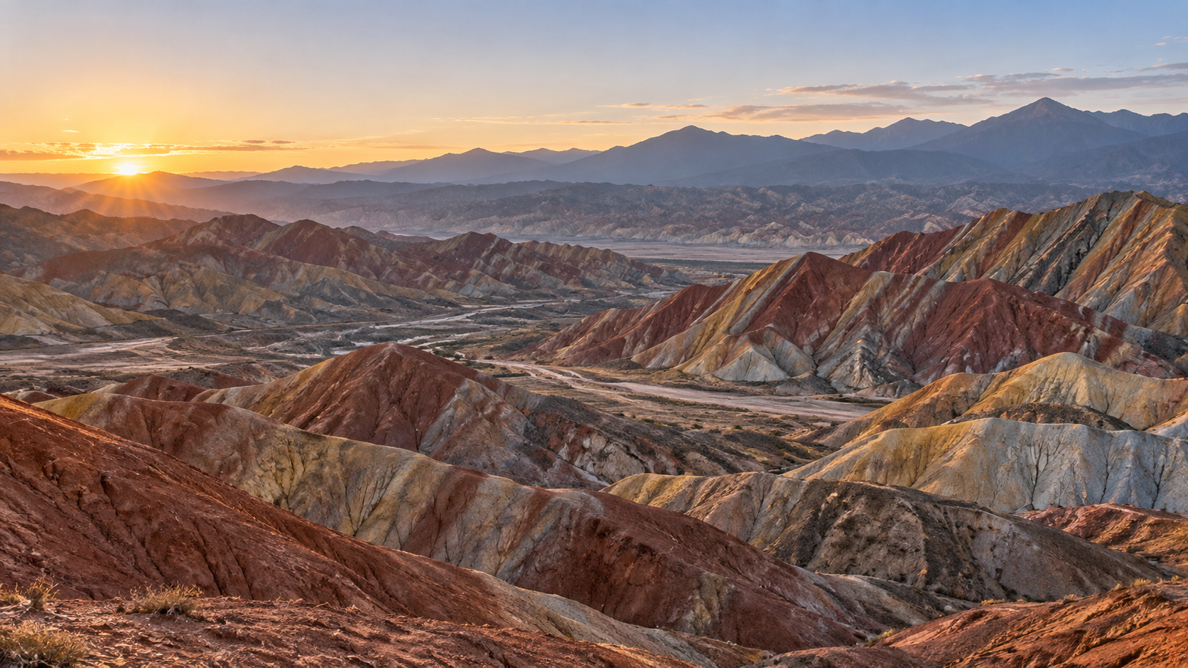
Zhangye Danxia is more than a mountain painted in many colors; it is a folded record of geological time.
张掖丹霞不只是一座被画上多种颜色的山;它还是一部被折叠的地质时间记录。
The Colorful Hills lie in Zhangye City, Gansu, near the northern Qilian Mountains.
七彩丘陵位于甘肃张掖,靠近祁连山北麓。
Their story begins with layers laid down in an ancient river-and-lake basin.
它们的故事始于古老河湖盆地中沉积下来的岩层。
During the Early Cretaceous, sandstone, conglomerate, and mudstone accumulated in front of the Qilian Mountains.
早白垩世,砂岩、砾岩和泥岩在祁连山前逐渐沉积。
These are sedimentary rocks, made from material carried and settled by water.
这些是沉积岩,由水搬运并沉降的物质形成。
The layers did not remain flat.
这些岩层没有一直保持平坦。
Later tectonic forces folded and lifted them, turning a quiet bed into long colored ridges.
后来,构造力量使它们褶皱、抬升,把安静的沉积层变成长长的彩色山脊。
That is why the hills look like waves that have stopped moving.
所以,这些山丘看起来像凝固的波浪。
Color is part of the record too.
颜色也是这份记录的一部分。
Iron-bearing minerals help create red, yellow, gray, and blue-gray bands in the rock.
含铁矿物帮助岩层形成红、黄、灰和蓝灰色的条带。
Changes in the old environment altered the chemical conditions in which those minerals formed.
古老环境的变化,改变了这些矿物形成时的化学条件。
So the stripes are not paint added to the surface; they are differences preserved inside the layers.
所以,这些条纹不是后来涂在表面的颜料;它们是保存在岩层内部的差异。
Layer thickness and weathering then write a second pattern across the hills.
随后,岩层厚度和风化作用又在山丘上写下第二重图案。
Where bands are repeated, the slopes resemble folded cloth or waves under a low sun.
当条带反复出现,山坡就像折叠的布匹,也像低斜阳光下的波浪。
But color alone does not make this landscape.
但颜色并不是这片地貌的全部。
In this dry region, wind, seasonal rain, running water, freeze-thaw, and gravity keep shaping the exposed rock.
在这片干旱地区,风、季节性降雨、流水、冻融和重力持续塑造着裸露的岩石。
Water cuts channels, while wind and temperature break weaker surfaces apart.
流水切出沟槽,风和温度变化则拆解较脆弱的表面。
The same forces can cut a channel, steepen a wall, or leave a softer layer behind.
同一套力量可以切出沟槽、削陡岩壁,也可以留下更柔软的岩层。
What matters is the meeting of structure and erosion: folds set the direction, and weather shapes the details.
重要的是结构与侵蚀的相遇:褶皱决定方向,天气塑造细节。
Seen from a viewing trail, one ridge becomes a cross-section of time.
从观景步道望去,一条山脊就成了时间的剖面。
The trail is also a line of protection.
这条步道也是一条保护线。
Zhangye Geopark divides sensitive land into protection zones; some areas are closed, while visitors use designated paths, fences, and signs.
张掖地质公园把敏感区域划入保护分区;有些区域不对游客开放,游客则使用指定步道、围栏和标识。
Where old development damaged parts of the park, restoration has followed a principle of natural recovery first, with human help as support.
对于过去开发损伤的部分区域,修复遵循以自然恢复为主、人工帮助为辅的原则。
When we leave the trail, the colors remain still, but erosion continues its patient work.
当我们离开步道,颜色仍然静止,侵蚀却继续耐心地工作。