LANDSCAPE · E0060
恩施大峡谷:石头打开的道路
Enshi Grand Canyon: Where Stone Opens Paths
WORD BY WORD
进入逐词听读模式
顶部配图随进度轮播,未读文字为白色,读到后逐词变黄。
从碳酸盐岩、清江切割、峰丛绝壁与云龙河地缝,走到依山吊脚楼、山地农耕和活态歌舞传统,理解恩施的地质空间如何进入日常生活。
THREE THINGS TO KNOW
- 01
恩施大峡谷—腾龙洞世界地质公园位于湖北省西南部,2024年获联合国教科文组织世界地质公园称号。
- 02
公园出露寒武纪至白垩纪地层,广泛分布的二叠纪和三叠纪碳酸盐岩构成主要喀斯特地貌基础。
- 03
区域经历分阶段构造抬升,清江水系深切地表,形成陡崖、深峡谷、消失河段和大型洞穴系统。
BILINGUAL TRANSCRIPT
双语全文
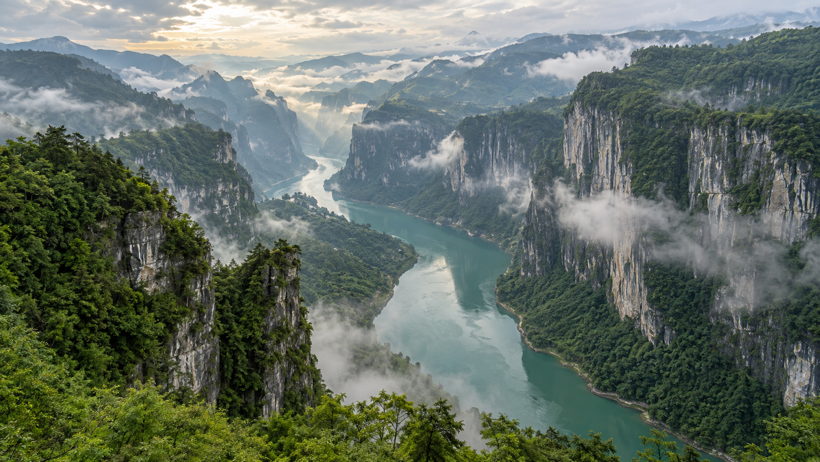
Enshi Grand Canyon is more than a deep mountain cut; it opens paths through stone.
恩施大峡谷不只是一道切入群山的深谷;它还在岩石间打开道路。
It lies in southwestern Hubei, where the Wuling Mountains surround the Qingjiang River.
它位于湖北西南部,武陵群山环绕着清江。
In 2024, the wider Enshi Grand Canyon-Tenglongdong Cave area became a UNESCO Global Geopark.
2024年,范围更广的恩施大峡谷—腾龙洞地区成为联合国教科文组织世界地质公园。
Its shape begins with Permian and Triassic carbonate rock.
它的形态始于二叠纪和三叠纪的碳酸盐岩。
Water entered cracks, dissolved rock, and found routes above and below ground.
水进入裂隙、溶解岩石,并在地上与地下寻找通道。
Step-by-step uplift raised the land, while the Qingjiang River cut deeper.
分阶段的抬升托高地面,清江则向更深处切割。
That long process left steep cliffs, deep gorges, caves, and rivers that disappear underground.
这一漫长过程留下了陡峭绝壁、深谷、洞穴和潜入地下的河流。
What looks like one canyon is therefore a three-dimensional network of visible and hidden spaces.
因此,看似一条峡谷的地方,其实是一张由可见与隐藏空间组成的立体网络。
Here, walls of rock can stand beside clusters of narrow peaks, a striking feature of the Enshi landscape.
在这里,岩壁可以与密集的细长峰丛并立,这是恩施山水的鲜明特征。
At Qixingzhai, limestone pillars rise close together like a forest made of separate trunks.
在七星寨,石灰岩峰柱密集升起,仿佛一片由独立树干组成的森林。
Some remain joined to a cliff, while others stand alone above the valley.
有些峰柱仍与绝壁相连,另一些则独立于山谷之上。
The Yunlong River Fissure tells the same story at a smaller scale, through a narrow channel and layered walls.
云龙河地缝以更小的尺度讲述同一故事,狭窄水道穿过层叠岩壁。
Its rocks even preserve evidence of ancient volcanic activity near the boundary between two geological periods.
它的岩石甚至保存着两个地质时期交界附近古老火山活动的证据。
Yet the canyon is not only a record of how water moved; it also shaped how people used limited space.
然而,峡谷记录的不只是水如何移动;它也影响了人们如何使用有限空间。
Traditional farming followed mountain slopes, while villages used limited land in careful layers.
传统农耕顺着山坡展开,村寨则分层使用有限的土地。
Tujia stilt houses answer the same problem by following the slope instead of forcing the mountain flat.
土家吊脚楼回应着同一个难题:顺应山势,而不是强行把山地削平。
Wooden frames and raised floors turn a steep piece of ground into useful living space.
木质框架与架空楼层把一块陡坡变成可以使用的生活空间。
The same mountain world also lives in folk songs, hand-waving dances, festivals, woodwork, and brocade.
同一片山地世界也生活在民歌、摆手舞、节庆、木作与织锦之中。
These traditions belong to living communities of Tujia, Miao, Dong, and other local people, not to a museum display.
这些传统属于土家族、苗族、侗族及其他当地居民的活态社区,而不是博物馆里的静态展品。
Geology and culture do not sit on opposite sides of the view; both grew through daily choices in the same terrain.
地质与文化并不分处风景的两边;二者都在同一地形中的日常选择里延续。
The geopark now links conservation with school education, community projects, and local tourism.
如今,地质公园把遗产保护与学校教育、社区项目和本地旅游连接起来。
The more clearly residents and visitors understand the land, the more carefully its paths can be shared.
居民与来访者越清楚地理解这片土地,它的道路就越能被谨慎共享。
Protecting Enshi therefore means keeping more than cliffs and caves; it also means keeping knowledge in use.
因此,保护恩施不只是保存绝壁与洞穴,也意味着让知识继续被使用。
Between the Qingjiang River and the high stone pillars, each path carries both the memory of water and the steps of people.
在清江与高耸石柱之间,每一条道路都承载着水的记忆与人的脚步。